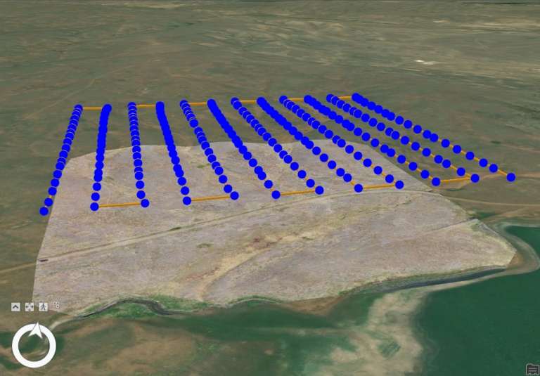
Skip to content

  • Home
  • ProjectsExpand
    • Publications
  • People
  • Learning
  • ServicesExpand
    • Equipment
  • Resources
  • Events
  • Contact Us
Mapping the Thermal Flow: Best Practices in River and Riparian Temperature Monitoring with TIR Imagery
College of Natural Resources | Projects | Uncategorized

Mapping the Thermal Flow: Best Practices in River and Riparian Temperature Monitoring with TIR Imagery

We are using thermal infrared (TIR) imagery to map thermal profiles in rivers and riparian areas at the reach scale in the upper Big Creek drainage of Central Idaho.

Read More Mapping the Thermal Flow: Best Practices in River and Riparian Temperature Monitoring with TIR ImageryContinue

Structure from Motion with Historic Aerial Photos
Learning

Structure from Motion with Historic Aerial Photos

LEARNING Structure from Motion with historic aerial photographs. Modern photogrammetry software is a powerful tool for orthorectifying and merging historic aerial photographs into digital map products that can be used in GIS maps and analyses. The concepts of photogrammetric mapping can be applied to any…

Read More Structure from Motion with Historic Aerial PhotosContinue

Page navigation

Previous PagePrevious 1 2

Contact us if you have a drone-related announcement or activity you would like to share.


Recent Posts

  • The Year in Drone – 2024
  • Post-processing Emlid GNSS data with OPUS corrections
  • Thermal Image Photogrammetry in Metashape
  • Combining Lidar with Photogrammetry in Metashape
  • Processing Lidar Data in Yellowscan CloudStation

Categories

  • Announcement
  • College of Agriculture and Life Sciences
  • College of Natural Resources
  • Learning
  • People
  • Projects
  • Uncategorized

© 2025

Powered by: RCDS

  • Home
  • Projects
    • Publications
  • People
  • Learning
  • Services
    • Equipment
  • Resources
  • Events
  • Contact Us