Skip to content

  • Home
  • ProjectsExpand
    • Publications
  • People
  • Learning
  • ServicesExpand
    • Service Inquiry
    • Drone Data for Small Landowners
    • Our Equipment
  • Resources
  • Events
  • Contact Us
  • Automating workflows for processing and classification of drone imagery to monitor grassland conservation easements
    College of Natural Resources | Projects

    Automating workflows for processing and classification of drone imagery to monitor grassland conservation easements

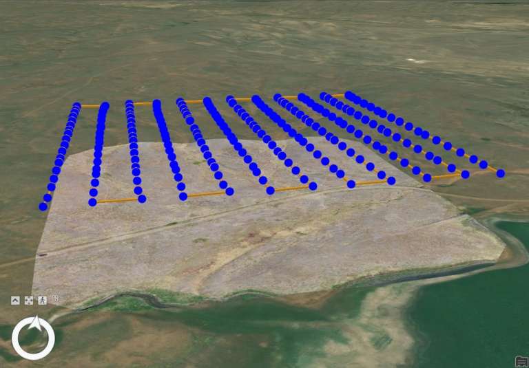
    The University of Idaho’s Drone Lab has worked with the Montana Chapter of The Nature Conservancy to develop and refine workflows for automated processing of drone imagery into indicators of ecosystem health.

    Read More Automating workflows for processing and classification of drone imagery to monitor grassland conservation easementsContinue

Contact us if you have a drone-related announcement or activity you would like to share.


Recent Posts

  • Point Clouds and Elevation Surfaces in Metashape
  • The Year in Drone – 2024
  • Post-processing Emlid GNSS data with OPUS corrections
  • Thermal Image Photogrammetry in Metashape
  • Combining Lidar with Photogrammetry in Metashape

Categories

  • Announcement
  • College of Agriculture and Life Sciences
  • College of Natural Resources
  • Learning
  • People
  • Projects
  • Uncategorized

© 2026

Powered by: RCDS

  • Home
  • Projects
    • Publications
  • People
  • Learning
  • Services
    • Service Inquiry
    • Drone Data for Small Landowners
    • Our Equipment
  • Resources
  • Events
  • Contact Us