Combining Lidar & Photogrammetry in Metashape
In this lab, we will explore how to bring lidar data into Metashape, align the lidar point cloud with a set of photos, use the lidar as the basis for orthorectifying the photos, and explore the differences between the lidar and photogrammetric point clouds.
The main goals of this lab exercise are to familiarize students with:
- How to import and display lidar data in Metashape
- Processes for aligning lidar data with photogrammetric products in Metashape
- How to use lidar data as an elevation source for orthorectification
- Differences between lidar and photogrammetric point clouds
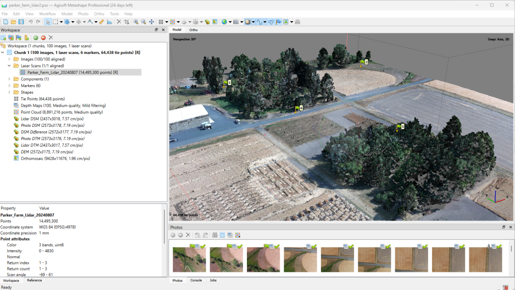
To date, we have considered only elevation data that we derive from the photogrammetric process in our Metashape projects. Those elevation data can be used for analyses (e.g., calculating canopy height, examining change over time, calculating volume) or as a source for orthorectifying aerial photos. However, other sources of elevation data can be brought into Metashape and used in place of photogrammetric 3D models.
Over the past few years, lidar data collected from drones has become more prevalent and affordable. Lidar is an active sensor technology that measures distance between the sensor (mounted on a drone in our case) and an object (e.g., the ground, vegetation, buildings) based on the time it takes for a laser pulse emitted from the sensor to be reflected off the object and measured back at the sensor. Because the lidar sensor is emitting the laser pulses (i.e., radiation) it is measuring, and because those laser pulses are small in spatial footprint, some of those pulses will make it through plant canopies and give elevation information on canopy structure and even ground surface under canopies. Thus, lidar data provides a much more complete picture of the ground surface and structure of vegetation compared to photogrammetric point clouds that can only estimate elevations for objects that can be seen in more than one photograph.
Additionally, lidar data can be used as a source of elevation data for orthorectifying drone-collected aerial imagery, potentially saving considerable processing time in photogrammetric projects (i.e., removing the need to build dense photogrammetric point clouds or mesh models). Using lidar data in this way, however, requires coregistration of the lidar data with the photogrammetric model.
In this lab, we will explore how to bring lidar data into Metashape, align the lidar point cloud with a set of photos, use the lidar as the basis for orthorectifying the photos, and explore the differences between the lidar and photogrammetric point clouds.
