Processing Lidar Data in Yellowscan CloudStation.
Raw lidar data collected from Yellowscan sensors must be processed through CloudStation to produce high-accuracy point clouds and elevation models.
CloudStation is the application for processing of the raw lidar data from Yellowscan lidar sensors into high-accuracy final point clouds and elevation models. Because CloudStation is commercial, licensed software, this tutorial will only be useful to University of Idaho faculty/staff/students or others who have access to a CloudStation license. This is not a comprehensive review of CloudStation, but rather is a summary of the reliable workflow that we have developed for processing the lidar data from our Yellowscan Surveyor Ultra 3 sensor. This tutorial requires:
- The raw data collected from the lidar unit,
- A RINEX log file for the GNSS base station, and
- A csv file of ground control points (optional)
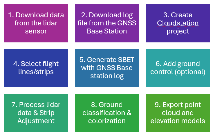
The main workflow steps for processing lidar data are:
This tutorial covers processing of lidar data that has already been collected. A separate tutorial will cover steps to successfully collecting lidar data with the Yellowscan Surveyor Ultra 3.